Silverthorne Seismic, LLC

3D Seismic

How to Avoid the Historical Problem of the 600ft Surface Offset Dry Hole Location

How to Avoid the Historical Problem of the 600ft Surface Offset Dry Hole Location

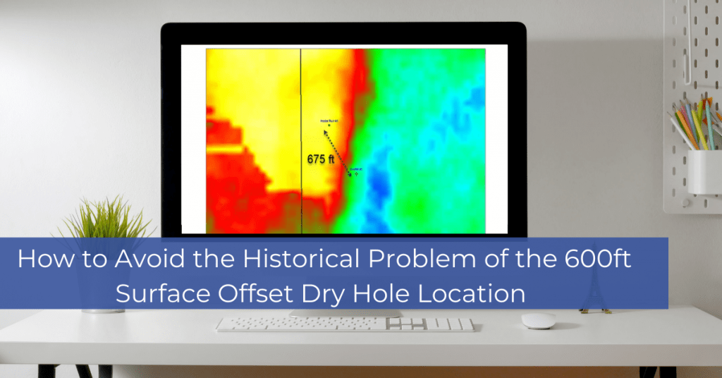
How to Avoid the Historical Problem of the 600ft Surface Offset Dry Hole Location: The webinar illustrates how common the simple error of mistaking WGS84 UTM with the same zone in NAD27 UTM impacts our industry. The first step of risk mitigation is understanding the coordinate reference System (CRS) that your data is in. When […]

How to Avoid the Historical Problem of the 600ft Surface Offset Dry Hole Location Read More »

East Knox 3D

East Knox 3D

East Knox 3D: Silverthorne announces the availability of 205 Square miles of seismic in the SCOOP play in Southern Oklahoma. Silverthorne Seismic, LLC and its partner Wilson Geophysical, Inc. have been active in the seismic brokerage, management, and acquisition business since 1978. With the acquisition of the North Scoop 3D, Silverthorne Seismic, LLC now owns

East Knox 3D Read More »

South Scoop 3D Seismic Survey Stephens and Carter Counties, OK

Silverthorne Seismic LLC Begins South Scoop 3D Seismic Survey: Stephens and Carter Counties, OK

HOUSTON, Aug. 20, 2018 Affiliates of Silverthorne Seismic, LLC have begun acquisition of a large multi-client 3D seismic project located in the heart of Oklahoma’s SCOOP play. The South Scoop 3D will be acquired by Dawson Geophysical Company for Silverthorne. Permitting on the project began in late July. The project, which covers 250 square miles, will

Silverthorne Seismic LLC Begins South Scoop 3D Seismic Survey: Stephens and Carter Counties, OK Read More »

Scroll to Top