2D vs 3D Seismic Acquisition: What's the Difference & Which Do You Need?
Table of Contents
If you’re planning a seismic program, or evaluating whether to license existing data or acquire new coverage, one of the first decisions you’ll face is whether 2D or 3D acquisition is the right fit. The answer depends on your geological objectives, project stage, and what you need to know before the next drilling decision.
Both methods use the same fundamental physics: generating controlled acoustic waves at the surface, recording their reflections off underground rock layers, and processing those reflections into a subsurface image. What differs is how completely and accurately each method captures the three-dimensional reality of the subsurface — and what that means for the decisions that follow.
At Silverthorne Seismic, our team manages acquisition programs of both types and has worked with 2D and 3D datasets across the major U.S. basins and internationally. Here is a plain-language breakdown of what each method delivers and when each makes the most sense.
What is Seismic Acquisition?
Seismic acquisition is the process of generating controlled energy waves, sending them into the subsurface, and recording the reflected signals at the surface. The returning reflections carry information about the rock layers they bounced off — their depth, thickness, geometry, and physical properties.
On land, the energy source is most commonly a vibroseis truck, which applies a vibrating base plate to the ground across a defined frequency range. The reflected energy is captured by geophones — sensors placed either along a line (for 2D) or across a grid (for 3D). The recorded data is then processed and interpreted to produce a subsurface image that guides exploration and development decisions.
The difference between 2D and 3D seismic begins with how those geophones are deployed and how the resulting data is structured.
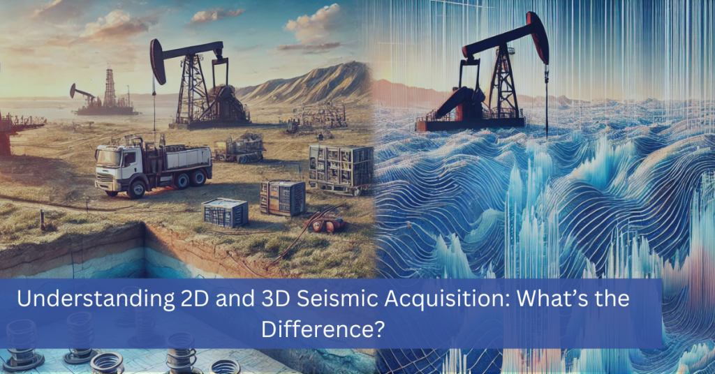
2D Seismic Acquisition: Regional Reconnaissance
2D seismic acquisition collects data along single, straight survey lines. The result is a series of vertical cross-sectional profiles — essentially slices through the subsurface along the path of each line. Think of it like looking at a loaf of bread from the side: you can see the internal layers clearly along the cut, but you have no direct information about what the loaf looks like between slices.
What 2D Seismic Does Well
For regional-scale reconnaissance — screening large areas for structural trends, mapping basin architecture, or identifying zones worth investigating further — 2D seismic is efficient and cost-effective. A single 2D survey line can cover tens to hundreds of miles, giving geologists a rapid first look at an area before committing to the expense of a full 3D program.
2D seismic remains the method of choice in frontier basins where the geology is largely unknown and the goal is to identify whether any exploration potential exists at all. It is also used in areas with simple, gently dipping geology where a cross-sectional view is genuinely sufficient to answer the geological question.
The Limitations of 2D Seismic
The fundamental limitation of 2D acquisition is that the subsurface is not two-dimensional. Real geological structures — faults, folds, channels, reefs, salt bodies — are three-dimensional objects. A 2D line images only what is directly below it, which means that reflections from structures to the side of the line (called out-of-plane reflections) can appear on the record and be misinterpreted as being directly beneath the survey line.
This is not a minor technical footnote — it has led to significant structural misinterpretation and consequent drilling failures in areas of complex geology. In mature basins where structural complexity is known, relying on 2D data for well placement carries real risk.
3D Seismic Acquisition: Volumetric Subsurface Imaging
3D seismic acquisition deploys sources and receivers across a grid pattern covering a defined area, collecting data simultaneously from multiple directions and angles. The result is a fully continuous three-dimensional volume of the subsurface — not a series of disconnected slices, but a complete spatial model that can be viewed, sliced, and analyzed in any orientation.
What 3D Seismic Delivers
The volumetric nature of 3D data fundamentally changes what a geoscientist can see and measure. Faults can be mapped in their true three-dimensional geometry. Channel systems can be followed laterally across the survey area. Amplitude anomalies that indicate fluid contacts or lithology changes can be mapped in plan view. Reservoir boundaries can be delineated with the spatial accuracy that drilling decisions demand.
For horizontal drilling programs — where a lateral may extend two miles or more through a target formation — 3D seismic provides the structural and stratigraphic control needed to design the well path and anticipate geological hazards before the bit encounters them. Without 3D data, geosteering in a complex or heterogeneous formation becomes significantly more difficult and costly.
Modern 3D Acquisition Technology
Today’s 3D acquisition programs benefit from wireless nodal recording systems that have largely replaced cabled geophone arrays, improving operational efficiency, reducing surface disturbance, and enabling higher receiver density without the logistical constraints of cable-based systems. Advanced processing techniques — including full-waveform inversion (FWI) for detailed velocity modeling and pre-stack depth migration for accurate structural imaging in complex settings — extract substantially more information from 3D data than was possible a decade ago.
Small Patch 3D: A Cost-Efficient Middle Ground
Not every 3D program needs to cover a large regional area. Small patch seismic is a targeted approach that acquires high-resolution 3D data over a focused area, typically 5 to 40 square miles, at a fraction of the cost of a full regional survey. For operators planning a multi-well pad, evaluating a specific structural target, or filling a data gap in an otherwise well-understood area, small patch 3D delivers the imaging precision of a full 3D program on a timeline and budget scaled to the project. A turn-key small patch program can deliver a processed 3D volume in 6 to 8 weeks from mobilization.
2D vs 3D Seismic: Side-by-Side Comparison
| Feature | 2D Seismic Acquisition | 3D Seismic Acquisition |
|---|---|---|
| Data Collection | Single survey lines — produce cross-sectional slices | Grid of source and receiver points — produces a volumetric model |
| Subsurface View | Vertical profile along a line; structures between lines are unseen | Full 3D volume viewable from any direction; no gaps in coverage |
| Spatial Accuracy | Out-of-plane reflections can distort structure geometry | Accurate spatial positioning of features in three dimensions |
| Resolution | Sufficient for regional mapping and structural trend identification | High-resolution imaging of reservoir geometry, faults, and internal heterogeneity |
| Cost | Lower upfront cost, typically 60–80% less than 3D over the same area | Higher acquisition cost offset by reduced drilling risk and better well placement |
| Processing Time | Faster — simpler processing sequence | Longer advanced velocity modeling, migration, and optional inversion |
| Ideal Scale | Regional screening, frontier basins, large areas with simple geology | Prospect-scale and field development, anywhere drilling decisions are at stake |
| Ideal Scale | Ideal Scale | Ideal Scale |
| Ideal Scale | Ideal Scale | Ideal Scale |
How to Choose: 2D or 3D for Your Project
The right answer depends on what geological question you need to answer and what decision you’ll make with the result. The guide below reflects the practical decision logic our team applies when advising clients on program design.
| Choose 2D Seismic When... | Choose 3D Seismic When... |
|---|---|
| You’re screening a large, frontier area for structural trends before committing to a more detailed program.Budget constraints make full 3D coverage impractical for the current phase.The geology is relatively simple and a cross-sectional view is sufficient to answer the question at hand.You need rapid reconnaissance over a very large area — hundreds to thousands of square miles.You plan to follow up with 3D acquisition if 2D results are encouraging. | You’re planning to drill — well placement decisions need accurate structural and stratigraphic geometry.The reservoir or structural target is complex — faulted, folded, or laterally variable.You’re developing a known field and need reservoir characterization for infill drilling or production optimization.You’re evaluating a multi-well pad — one 3D survey covers all laterals more cost-effectively than individual solutions.You’re assessing a CCUS storage site, geothermal prospect, or other application where subsurface integrity matters. |
In practice, many exploration programs use 2D and 3D seismic in sequence, 2D for initial screening over a large area, followed by 3D acquisition focused on the most promising prospects identified by the 2D results. This staged approach balances cost efficiency in early exploration with the imaging precision required as programs advance toward drilling.
Before Acquiring New Data: Check What Already Exists
Before committing to a new acquisition program — 2D or 3D — it is worth determining whether existing seismic coverage in your area of interest can meet your needs. A significant volume of historical 2D and 3D seismic data is available for licensing across virtually all of the major U.S. basins and many international plays.
Existing data can often be licensed faster and at lower cost than new acquisition, and in some cases legacy coverage, even from older vintages, provides sufficient structural control for early-stage evaluation. Where existing data quality falls short of current needs, it may still be valuable as a baseline for planning a more targeted new acquisition program.
Silverthorne Seismic brokers existing 2D and 3D seismic data across all major basins, including as an authorized broker for EOG Resources datasets. Our team can conduct a data search for your specific area of interest and advise on whether available coverage meets your objectives or whether new acquisition is warranted.
Looking for Existing Seismic Data?
Planning a New Acquisition Program?
Frequently Asked Questions: 2D vs 3D Seismic
Not necessarily — it depends on the objective. 3D seismic provides far more spatial information and is the right choice when drilling decisions, reservoir characterization, or structural accuracy are at stake. But for early-stage regional reconnaissance over a large area, 2D acquisition is more cost-effective and often entirely sufficient. The right method is the one that answers your geological question at the appropriate level of detail for the current project stage.
3D seismic typically costs significantly more than 2D over the same geographic area — often several times more — due to the higher receiver and source density, longer acquisition time, and more complex processing. However, the relevant comparison is not just acquisition cost but total program cost, including drilling. A 3D dataset that reduces or eliminates a dry hole or sidetrack more than pays for itself. For multi-well pad development, the cost per well drops substantially when one 3D program covers all planned laterals.
2D seismic can be used to identify structural targets and establish a general drilling location, but it rarely provides the stratigraphic detail and spatial accuracy needed for precise horizontal well placement. Long horizontal laterals — particularly in unconventional plays where staying within a specific formation over thousands of feet is critical — generally require 3D seismic to design and execute effectively.
Small patch seismic is a targeted 3D acquisition approach that covers a focused area — typically 5 to 40 square miles — rather than a large regional survey. It delivers high-resolution 3D imaging over a specific prospect, pad location, or data gap at a cost and timeline appropriate for smaller-scale programs. A turn-key small patch program can deliver a processed volume in 6 to 8 weeks from mobilization.
A seismic data broker with strong knowledge of available datasets in a given basin can conduct a coverage search for your specific area of interest. Silverthorne Seismic offers this service — contact our team with your area of interest and we will identify what existing 2D and 3D coverage is available and whether it meets your project objectives.
A full-service seismic acquisition partner manages every phase of the program: geological objective review, survey design, permitting and right-of-way acquisition, field crew coordination, data acquisition, processing, quality control, and data delivery. Silverthorne manages 2D, 3D, and small patch seismic programs as turn-key engagements — one team, one contract, from first planning session through final processed volume.
Have questions about seismic methods for your project?
Whether you're evaluating a new area of interest, planning an acquisition program, or trying to determine whether existing data meets your needs, our team is ready to help. Silverthorne Seismic manages full-lifecycle seismic programs and brokers data across all major basins.
Contact Us