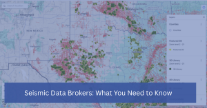
Seismic Data Brokers: What You Need to Know
In the world of oil and gas exploration, mining, and environmental assessments, seismic data is a key asset. It provides critical insights into the Earth’s subsurface, helping companies identify resources, assess structural risks, and make informed decisions. However, acquiring high-quality seismic data can be both expensive and time-consuming. This is where seismic data brokers come
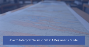
How to Interpret Seismic Data: A Beginner’s Guide
Seismic data is a crucial tool in industries like oil and gas exploration, geology, and even earthquake studies. It provides valuable insights into the Earth’s subsurface, allowing scientists and engineers to create detailed models that help in resource discovery, structural assessments, and environmental protection. However, understanding and interpreting seismic data can seem daunting, especially for
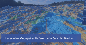
Leveraging Geospatial Reference in Seismic Studies
In seismic studies, understanding the precise location of underground structures is just as important as interpreting the data itself. This is where geospatial reference comes into play. Geospatial technology, which incorporates geographic information systems (GIS), remote sensing, and GPS, provides the framework for mapping and analyzing the spatial relationships between geological features. By leveraging geospatial
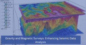
Gravity and Magnetic Surveys: Enhancing Seismic Data Analysis
In the world of subsurface exploration, seismic data analysis is a powerful tool that helps industries like oil and gas, mining, and environmental science uncover valuable underground resources. However, when used alone, seismic data might not provide a complete picture of the subsurface. This is where gravity and magnetic surveys come into play, offering complementary
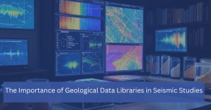
The Importance of Geological Data Libraries in Seismic Studies
In the realm of seismic studies, having access to comprehensive and well-organized geological data is critical. A geological data library serves as a centralized repository of subsurface information, offering vital insights that support seismic interpretation, exploration, and decision-making. Whether for oil and gas exploration, environmental assessments, or understanding geohazards, these libraries are indispensable resources for
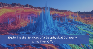
Exploring the Services of a Geophysical Company: What They Offer
Seismic ServicesThe field of geophysics plays a vital role in understanding the Earth’s subsurface. From identifying mineral deposits to locating oil and gas reservoirs and even assessing environmental risks, the services provided by a geophysical company are essential to industries like energy, construction, mining, and environmental management. But what exactly does a geophysical company do,

Cost-Effective Seismic Data Storage Solutions for the Energy Sector
In the energy sector, seismic data is a critical asset for exploration and production activities. Companies rely on this data to map subsurface formations, locate potential oil and gas reservoirs, and optimize drilling strategies. However, seismic data is typically massive in volume, requiring efficient storage solutions that can accommodate its scale while remaining cost-effective. Managing

Silverthorne Seismic to Attend NAPE Summit 2025 – Let’s Connect!
Silverthorne Seismic is excited to announce that we will be attending NAPE Summit 2025, the premier event for networking, deal-making, and industry insights in the oil and gas sector. This year’s summit, taking place February 5-7, 2025, at the George R. Brown Convention Center in Houston, TX, will bring together top energy professionals, investors, and
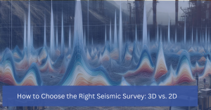
How to Choose the Right Seismic Survey: 3D vs. 2D
Seismic surveys are a crucial tool for mapping and analyzing subsurface formations in the oil and gas industry. They provide critical insights that help geologists, engineers, and exploration teams make informed decisions about where to drill and how to develop a field. However, one of the most important decisions a company must make is choosing

Understanding 2D and 3D Seismic Acquisition: What’s the Difference?
Seismic acquisition is an essential tool in the oil and gas industry for exploring subsurface structures and potential reservoirs. It provides critical data that helps geophysicists map underground formations, guiding drilling and production activities. The two primary methods used in this process are 2D seismic acquisition and 3D seismic acquisition. While both methods aim to
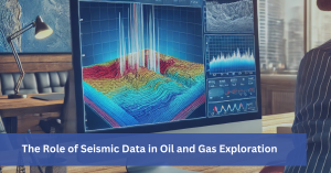
The Role of Seismic Data in Oil and Gas Exploration
In the oil and gas industry, making informed decisions about where to drill and how to develop resources requires precise and reliable data about the Earth’s subsurface. Seismic data, particularly 3D seismic, plays a crucial role in this process. It helps geophysicists and engineers identify potential reservoirs, evaluate risks, and optimize exploration efforts. Let’s explore

Small Patch Seismic: An Efficient and Cost-Effective Solution for Oil and Gas Exploration
Small patch seismic offers oil and gas companies a highly efficient and cost-effective solution for exploration and development activities. Its ability to provide a higher resolution image of a specific area makes it an ideal solution for identifying drilling problems and hazards and enabling accurate geosteering. One of the key advantages of this type of

Managing Contracts
Managing and storing contracts can be challenging. Physical contracts can take up a great deal of space in your office and leave the company vulnerable if there is a disaster. Archiving the physical contracts freeze up valuable office space and allows for contracts to be kept in a secure backup location. However, there still needs
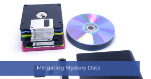
Mitigating Mystery Data
Mitigating Mystery Data: Have you ever come across a tape with very little information on what the data of the tape contained? Data Manager at Silverthorne Seismic, Julie Hagedorn, explains a couple of ways to identify the data on “mystery” tapes. First, looking at the type of tape, such as a 9 Track Tape, can

How Important are Colorbars in Kingdom?
Colorbars: They may seem like an afterthought compared to the interpretation and mapping side of geophysics, but they are essential for showing your work. Colorbars can enhance your work, or conversely, they can leave management wondering what they are looking at. Always ask yourself if there’s a better way to view the data. Know the

How to Avoid the Historical Problem of the 600ft Surface Offset Dry Hole Location
How to Avoid the Historical Problem of the 600ft Surface Offset Dry Hole Location: The webinar illustrates how common the simple error of mistaking WGS84 UTM with the same zone in NAD27 UTM impacts our industry. The first step of risk mitigation is understanding the coordinate reference System (CRS) that your data is in. When
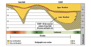
Scoop Acquisition
In 2019, Silverthorne completed the acquisition of the South Scoop 3D Survey. In this video, John Fortier discusses the pitfalls and challenges of seismic acquisition in one of the most challenging environments. From navigating infrastructure to figuring out how to infill source points, the Scoop surveys were challenging in every aspect. https://vimeo.com/663388539%20

What is a Coordinate Reference System?
What is a Coordinate Reference System (CRS)? Definition: A spatial reference system (SRS) or coordinate reference system (CRS) is a coordinate-based local, regional or global system used to locate geographical entities. A spatial reference system defines a specific map projection, as well as transformations between different spatial reference systems. Spatial reference systems are defined by
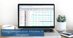
Fixing Interpretation Mistakes In Kingdom
Fixing Interpretation Mistakes In Kingdom: While we talk a lot about the most efficient ways to interpret seismic data in Kingdom, we don’t talk much about what to do when you make a mistake. Kingdom has many tools that let you fix and update horizons without deleting interpretations that you want to keep. Knowing the

Horizon Interpretation Summary
Horizon Interpretation Summary: Kingdom provides many tools for interpreting seismic horizons. Choosing the right one can be important to getting the right interpretation and doing it most efficiently. One of Silverthorne’s Geophysicists, Dave Fenton, has created a short six-minute video highlighting the most often used interpretation options. We hope this helps you when navigating your