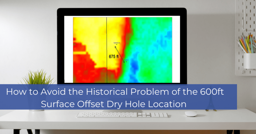
How to Avoid the Historical Problem of the 600ft Surface Offset Dry Hole Location: The webinar illustrates how common the simple error of mistaking WGS84 UTM with the same zone in NAD27 UTM impacts our industry. The first step of risk mitigation is understanding the coordinate reference System (CRS) that your data is in. When the same points are plotted on a map the difference in locations is only around 600 US feet and is not clearly seen unless you zoom into the map. This 600 US foot offset can cause an incorrect position to be drilled on and has historically factored in wells being dry holes. This discussion gives examples of 2D and 3D seismic data along with a seismic cross-section view. A simple navigation QC step will save any project from this issue.