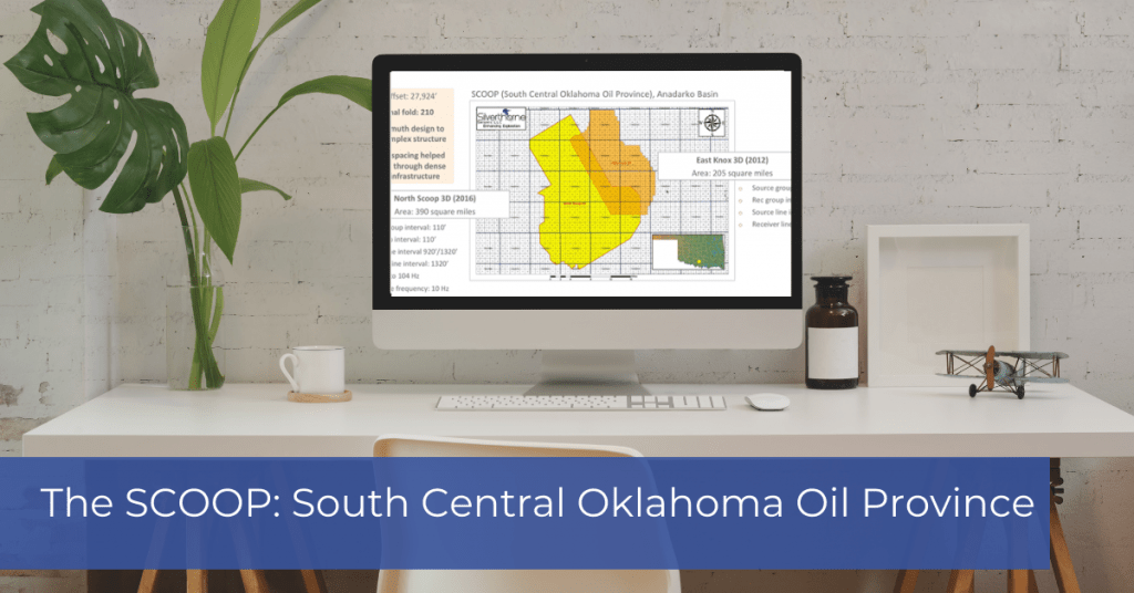
The SCOOP: South Central Oklahoma Oil Province – Chuck Diggins from DownUnder Geosolutions gives an informative presentation on the SCOOP with the help of Silverthorne VP, John Fortier. The South-Central Oklahoma Oil Province expands across major oil-producing counties in Oklahoma; Grady, Garvin, Stephens, Jefferson, and Carter counties. Watch the video below to learn more about the SCOOP and its comprehensive time processing workflow. The Mega-Scoop 3D was acquired from 2016-2019 (new acquisition) and merged with existing surveys acquired in 2012 (East Knox & Loco). The parameters for the North Scoop 3D were designed image structurally complex deep Woodford objectives, as well as shallower stacked pay zones. The acquisition was challenging due to the large amount of existing oilfield infrastructure that required buffering. The processing consisted of thorough picking of velocities and statics; then, the data was processed through a Kirchoff PrSTM. Once the models were built, additional Kirchoff PrSDM processing flows were applied as well as an RTM workflow. This enhanced processing allows the operators in the area to see the subtle details that can get lost in standard processing flows resulting in better production from unconventional and conventional wells. |